Drone Solutions
Confined Spaces Inspection
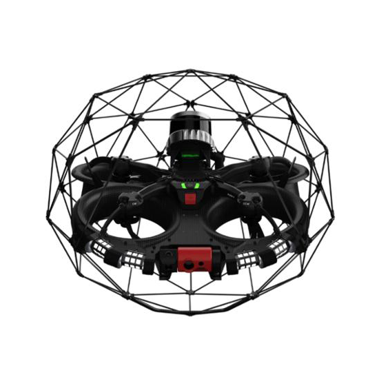
Drones are changing how inspections are done in confined and hazardous environments. Built to navigate tight, GPS-denied spaces, they offer a safer and more efficient alternative to traditional methods. With features like collision tolerance, real-time video, and 3D mapping, they enable detailed visual inspections without endangering personnel. Industries like oil & gas, mining, energy, and manufacturing benefit from reduced downtime, better accuracy, and improved safety.
Precise Aerial Mapping & Surveying
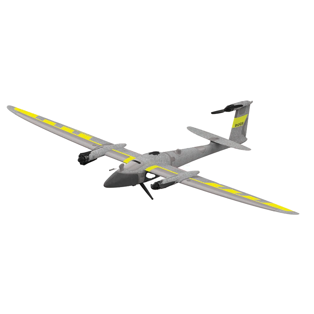
Drones have redefined aerial mapping with their ability to capture high-resolution geospatial data quickly and accurately. With vertical take-off capability and support for various payloads, they streamline surveying workflows, enhance precision, and reduce operational costs across industries like agriculture, construction, and environmental monitoring.

Drone technology has become a vital tool for aerial surveying and geospatial data collection. With VTOL capabilities and advanced sensor integration, modern drones enable high-precision mapping over large, complex, or remote areas. Compared to multirotors, fixed-wing drones can survey areas up to 10× faster, making them ideal for large-scale projects. Today’s drone platforms offer end-to-end solutions from mission planning and autonomous flight to cloud-based processing and data sharing streamlining the entire workflow. Integrated ground control verification can deliver up to 3 cm absolute accuracy, empowering professionals in land development, mining, infrastructure, and environmental monitoring to achieve reliable results with greater efficiency and less manual effort.
DJI Enterprise Solutions for Inspection, Mapping & Facility Perimeter Monitoring
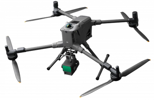
Our DJI Enterprise solutions including the MATRICE 400, MATRICE 4T, and DJI DOCK 3 deliver advanced aerial intelligence for inspection, mapping, surveillance, and autonomous operations. With multi-payload support, thermal imaging, LiDAR compatibility, RTK precision, and integration with DJI FlightHub 2, DJI Terra and DJI Modify, these platforms provide efficient mission planning, real-time monitoring, and reliable performance across oil & gas, utilities, construction, infrastructure, and facility safety applications.
West Bay Petroleum is the authorized DJI dealer for the Energy and Geospatial sectors, providing complete support including training, operational enablement, SOP development, demo deployments, and Proof of Concept (PoC) services as needed.
Our team includes DJI Certified Engineers for DJI solutions delivery, as well as DJI Certified Engineers for DJI Dock 3 deployment and maintenance, ensuring reliable and secure operations, besides Certified Engineers for DJI FlightHub 2 on-premises, non-cloud secure deployment tailored to enterprise IT and data security requirements.