Hovermap ST-X
Hovermap ST-X – High-Precision LiDAR Mapping Solutions
We are proud to offer the Hovermap ST-X from Emesent a leading LiDAR scanning and SLAM-based mapping system engineered for precision in complex and GPS-denied environments. With advanced autonomy, rugged design, and versatile deployment options, the ST-X is a powerful tool for industrial inspections, construction documentation, and large-scale 3D modeling.
Why Choose Hovermap ST-X?
- Precision SLAM Mapping – Achieve sub-centimeter 3D accuracy in indoor, outdoor, and confined-space environments.
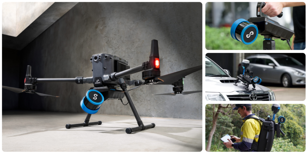
- Multi-Mode Deployment – Operate handheld, backpack-mounted, vehicle-mounted, or drone-mounted for maximum flexibility.
- GPS-Denied Ready – Capture reliable 3D data in tunnels, plants, vessels, and other challenging environments.
- Autonomy-Enabled – Supports autonomous drone flight using LiDAR-based navigation and obstacle avoidance.
- Rugged Construction – Industrial-grade durability with IP65 protection for demanding field conditions.
Advanced Capabilities
- LiDAR Mapping – High-resolution 3D scanning for engineering, construction, and asset documentation.
- Colorized Point Clouds – Produce true-to-reality colorized 3D data (supported on Hovermap ST-X and DJI L2; Elios 3 colorization coming soon).
- Confined-Space Scanning – Safely map tanks, vessels, tunnels, and inaccessible areas without exposing personnel.
- Digital Twins – Generate accurate as-built models for planning, monitoring, and inspections.