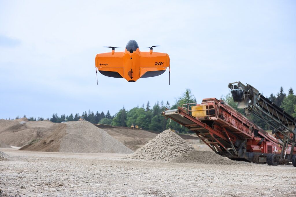
WingtraRAY Drone
WingtraRAY
We’re proud to introduce WingtraRAY, the latest VTOL drone built for modern geospatial professionals. Smarter, safer, and faster, it sets a new standard with advanced photogrammetry, LiDAR, and multispectral capabilities—all in a fully automated, high-performance platform.
Why Choose WingtraRAY?
- Intelligent Safety – Parachute-assisted landings and obstacle avoidance make it ideal for urban, populated, and complex environments
- High-Efficiency Mapping – Photogrammetry 40% faster than WingtraOne; 10× faster than multirotors.
- Versatile Payloads – Tailored for specific applications like 3D modeling, digital twins, crack detection, and environmental monitoring
- Long Flight Time – Covers large areas in a single flight, reducing operational time and cost
- High Accuracy – Achieves up to 3 cm absolute accuracy with PPK and ground control verification.
| Feature | WingtraRAY | WingtraOne GEN II |
| Photogrammetry Speed | ⚡ 40% faster | – |
| Obstacle Avoidance | ✅ Yes | ❌ No |
| Parachute Landings | ✅ Yes | ❌ No |
| Max Coverage / Flight | 550 ha (MAP61) | 450 ha |

Advanced Payload Options (Examples, but not limited to)
- Multispectral – Industry-leading sensors for agriculture, forestry, and environmental monitoring with high spectral accuracy.
- MAP61 – 61 MP full-frame sensor for ultra-high-resolution photogrammetry, ideal for large-scale topographic mapping and digital twins.
- LiDAR – High-efficiency 3D scanning for detailed terrain models and infrastructure analysis, even under vegetation.
- INSPECT – 85 mm telephoto lens with mm-level resolution, perfect for crack detection on roads, bridges, and runways.
- SURVEY24 – Cost-effective mapping solution for general surveying needs with excellent ground coverage.
Learn More From
Wingtra launches WingtraRAY: the drone built….
Wingtra has announced its new drone, WingtraRAY. The only drone designed specifically for surveyors, it breaks down limits that have held them back thanks to waiver-free operations over people (OOP)*……
Frequently Asked Questions
“VTOL Mapping drones for high-accuracy aerial surveying at scale”